Learning Map / Watery Treasures
The River Severn and the Two Bridges (Watery Treasures)
-
The River Severn
-
Winter sun on the Severn by the site of the Windbound
-
Severn Bridge sunset
-
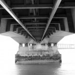
 Under the second Severn crossing
The River Severn
At 220 miles long the River Severn starts at Plynlimon in Wales and heads out to sea at Bristol. The River has one of the largest tidal ranges in Europe.
Curriculum links:
- Pupils should work scientifically by making systematic and careful observations and using a range of equipment including thermometers and data loggers (Year 3/4 Science).
- Pupils should understand geographical similarities and differences through studying the physical geography of a small area of the United Kingdom and of a small area in a contrasting non-European country (KS2 Geography).
Ideas for activities:
- Having made the appropriate risk assessments, access the River at various points along its course. Test the water and air temperature and use dataloggers to test the water content and pH of the soil. Record this information in a suitable table.
- Research the physical environment around the River Severn and contrast this with another completely different area across the other side of the world. Students could look at physical features, simple climate data and human impact on the environment.
- Go and see the Severn Bore or watch a video to see the amazing power of the tide.
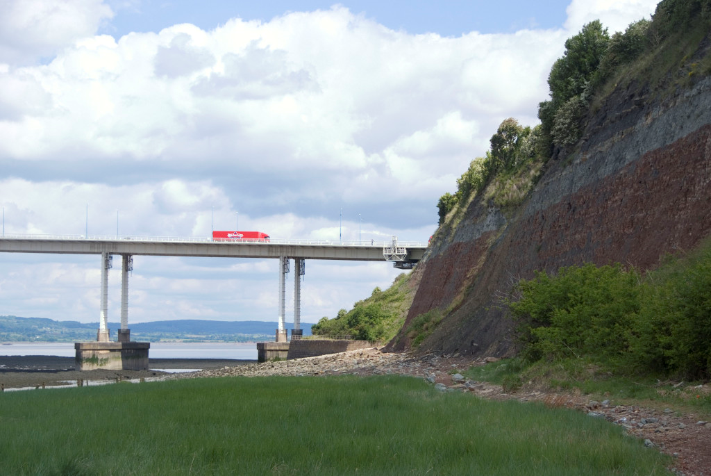
The Severn Crossings
The Severn crossings provide the two main routes between England and Wales. Completed in 1966 and 1996, they tower 130m above the Severn, the longest river in the UK.
Curriculum links:
- Pupils should be taught to identify and compare the suitability of a variety of everyday materials for particular uses (Year 2 Science).
- Pupils should be able to use simple compass directions and locational and directional language to describe the location of features and routes on a map (KS1 Geography).
Ideas for activities:
- Study the shapes of both bridges to discover how the Severn can be crossed. Students could use some of these shapes to design their own bridges according to certain criteria – length of span; weight to be supported etc.
- Spot the differences between the two bridges: students draw up a table to show the similarities and differences between the two bridges.
- Students could study a map of the area showing the bridges and use words like North, near and left to describe the position of the bridge relative to other key landmarks.
Did You Know?
Stand on Severn Beach to see the drama of both bridges. Public toilets are situated on Beach Road (left out of the station and first right) and are open daily.