Shaping the Landscape / Archaeology
Lidar - Remote Sensing the Forgotten Landscape
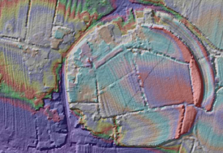
Lidar (light detection and ranging) is a term for an airborne laser survey that allows us to capture the landscape in great detail and create 3D models of the surface with and without vegetation. These 3D models have had a big impact on the world of archaeology, allowing us to visualise sites from Mayan Temples to ‘lost’ Roman roads here in the UK. Most excitingly, in 2015 the Environment Agency released their archive lidar data for free so that anyone can access and use it.
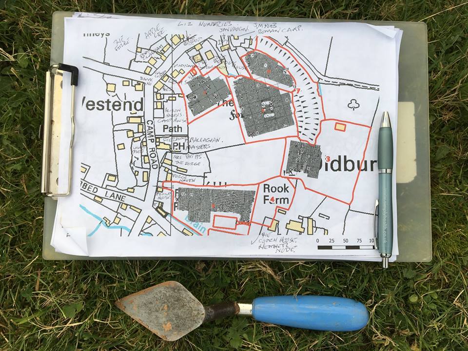
Early in 2017, A Forgotten Landscape supported a group of volunteers in learning all about lidar data, and how to identify and map archaeological features in a GIS (Geographical Information System). Once verified by our small team of professional archaeologists, the mapping contributed to the South Gloucestershire Historic Environment Record. The HER is available to browse as a layer on the Know Your Place South Glos website (switch on Archaeological Sites in the Information Layers menu on the right).
The skills learnt are repeatable and non-destructive to the landscape, so after mapping the Severn Levels area the volunteers can continue to map the rest of the district.