Learning Map / Under and Over
Kings Weston House (Under and Over)
Kings Weston Estate consists of an 18th century house and grounds with fantastic views over the River Severn. You can get a glimpse of the interiors by visiting the ground floor café and bistro, and the grounds provide an opportunity to study the outside of the house and the surrounding fields and large woodland areas.
Curriculum links:
- Pupils should be taught to improve their mastery of art and design techniques with a range of materials (KS2 Art).
- Pupils should use aerial photographs and plan perspectives to recognise landmarks and basic human and physical features, devise a simple map and use and construct basic symbols in a key (KS1 Geography).
- Pupils should make a study of an aspect of history or a site dating from a period beyond 1066 that is significant in the locality (KS2 History).
- Pupils should understand some of the ways in which we find out about the past (KS1 History).
Ideas for activities:
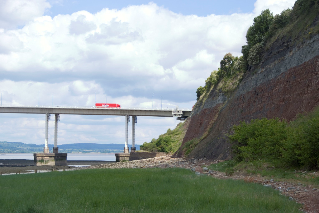
- Use the map to take a walk to the iron bridge and walk over the road. Look at the map of the estate (see link below) and write a short newspaper report, as a journalist in 1800, explaining why the bridge is so important and why the repairs that are needed are essential.
- Stand at the view point near the car park and look out over the River Severn. Students should make a sketch of the skyline using charcoal or pen and ink (materials common in the era this house was built) and label all the different industry and places of interest that they can see.
- In the classroom, before a visit, look at the huge variety of historical sources available from the Kings Weston Action Group website (KWAG) and illustrate how we know about the history of this estate. Students could pick out headlines and pictures of interest which they then note down and try and find the reference for that story or picture during a visit.
- Use the different historical features around the house and grounds to create a timeline showing how the house and grounds have changed over 300 years (medieval Bewy’s Cross by the stables; the compass dial on Penpole Point from the early 17th century; the Echo pavilion in 1724; remains of the WW2 barracks toilets on the south perimeter of the estate). The locations of all of these can be found on the Know Your Place website.
- Use a print-out of the illustration in the second web link with the students. Stand by the house and try and identify which points still exist and describe how the house and estate has changed.
Did You Know?
You can use the Kings Weston Action Group downloadable maps beforehand with students to plan your route around the estate. You can also use the Know Your Place website to find the remaining features at KWH before your visit.
Toilets are located through the café at the side entrance of the main house.